The Walks
Northern France and Channel Coast
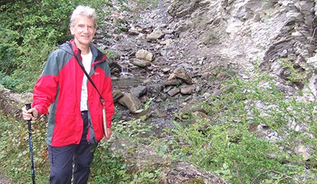
Photo: Terry in a remote spot
The region
Rivers, Lakes & Canals
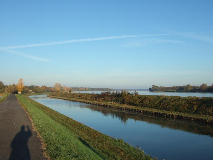
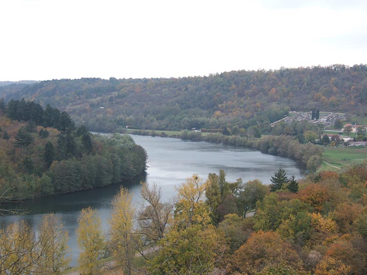
Three rivers cross the North Eastern corner of France - the Meurthe, the Moselle and the Meuse. They drain into the Rhine and the North Sea. Further west the rivers move south to the Seine, the Oise for example, and eventually due west to the Channel, like the Canche flowing to Etaples south of Boulogne.
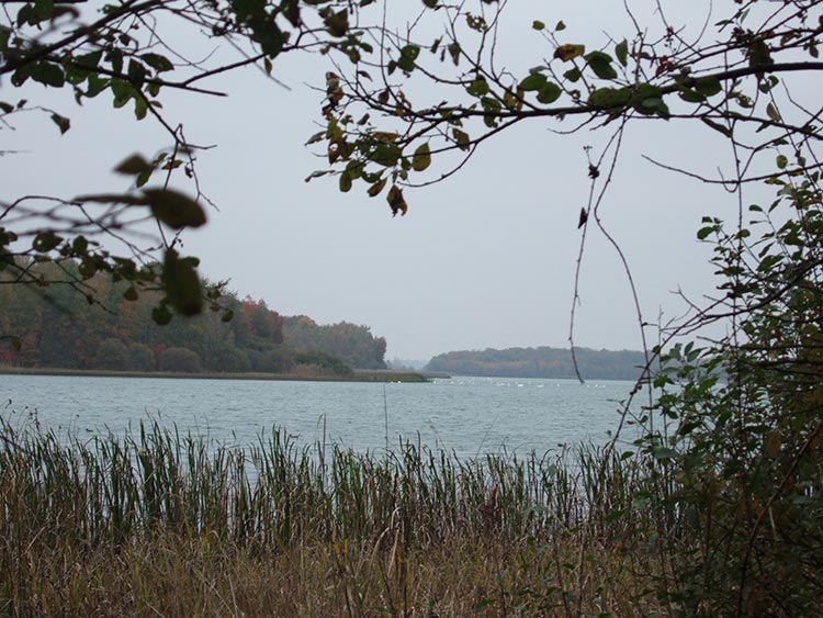
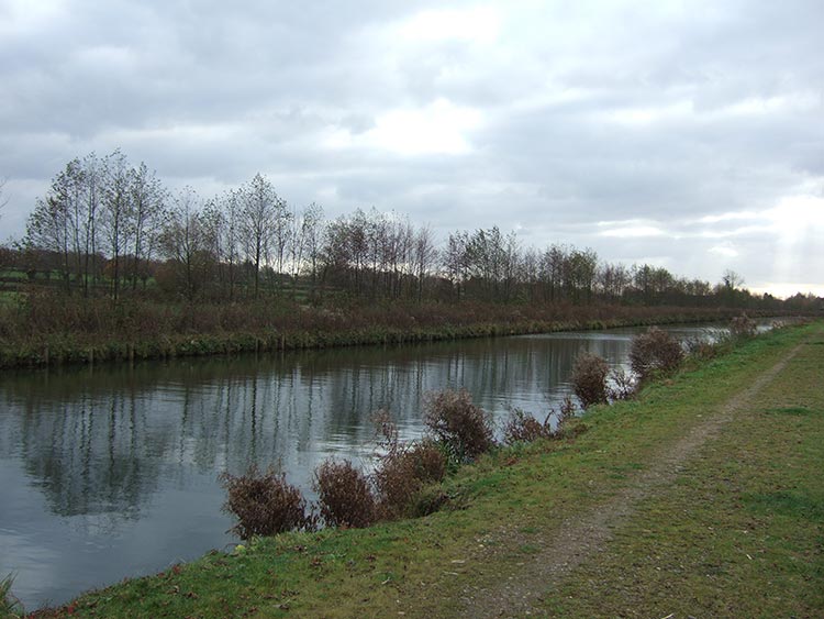
Many of these rivers are linked by canals and interspersing all these waterways are clusters of lakes, man made and natural, large and small. The Canal de la Sensee links Dunkerque to the Escaut River which runs through Cambrai. The landscape is typical of the department of the Nord - the wharves, the curving lines of the banks, the chugging of long barges, the flat open fields on either side, the screens of trees but above all the light of a wide open sky reflected off the water.
Landscape
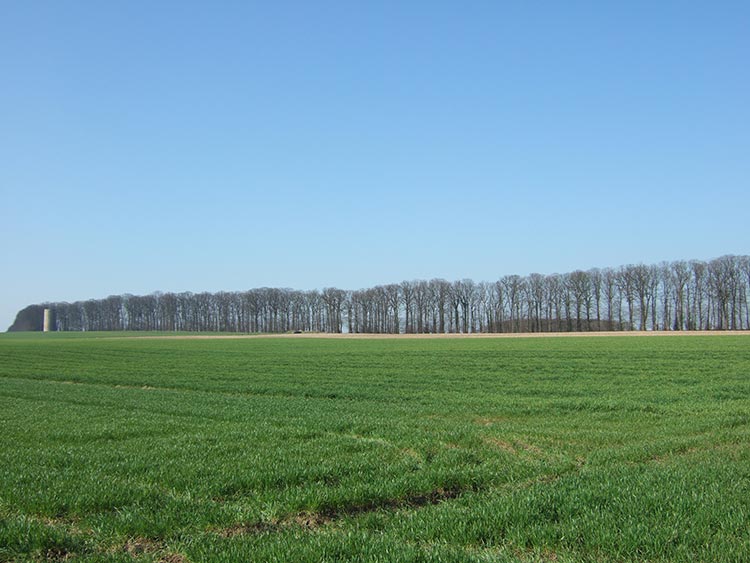
The landscape alternates constantly between bleak plateaus of open fields, mainly devoted to arable, and depressions where meadows full of cattle surround a meandering stream and where most villages lie.
The bocage of the Thierache has more hedges and ditches than elsewhere in the sweeping plains of the North.
Massive forests cover much of the region-circling Nancy, on the slopes above the Meuse, on the batlefield of Verdun, in the French Ardennes near Charleville and at Mormal east of Valenciennes.
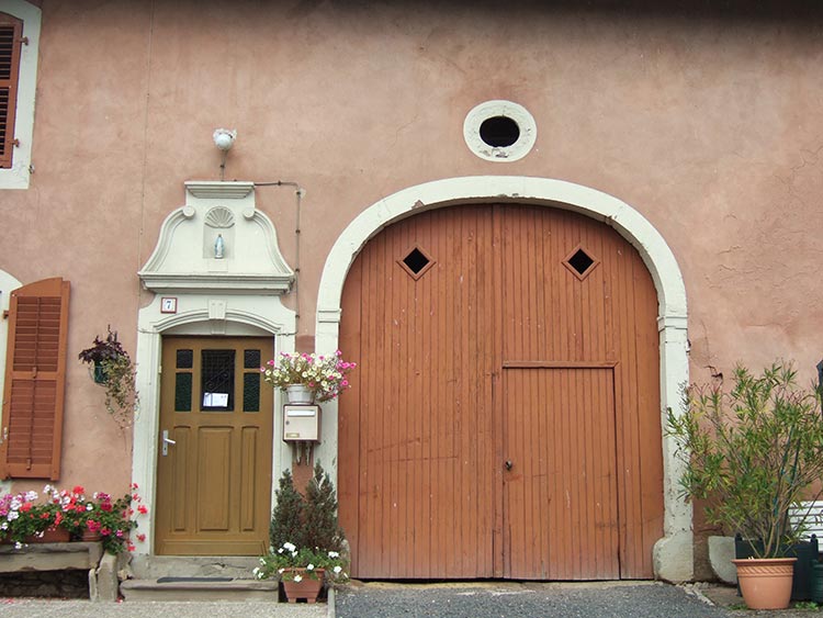
Local Architecture
tThe style of building in the villages changes as you cross from one ancient pays to another, from Lorraine to the Ardennes, to the Thierache and then on to Flanders.
The characteristic features of Lorraine villages include wide verges or usoirs used in former times to keep carts and equipment, stack wood and pile up manure; niches above doors containing statues of the Virgin; high arched gateways leading to yards behind.
In the streets of Nancy it is possible to trace the evolution from proud independent duchy to client state of France and finally to French region-the medieval streets of the oldest part of the city; the ostentatious grandeur of Louis XIV's baroque; the huge open space of the Place Stanislas, one of the finest public squares in France, with elaborate wrought iron grilles resplendent in black and gold and imposing eighteenth century buildings.
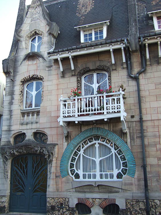
Nancy had a famous art nouveau school of architecture. The Maison Huot is the most entertaining example of this style, fun and quirky, a real jeu d'esprit. A Moorish window takes the shape of a leaf surrounded by vitreous turquoise tiles. The front door looks like a tree; mouldings of plants surround the other windows and chimney stacks; the pinnacles over the upper storey windows recall the Gothic style.
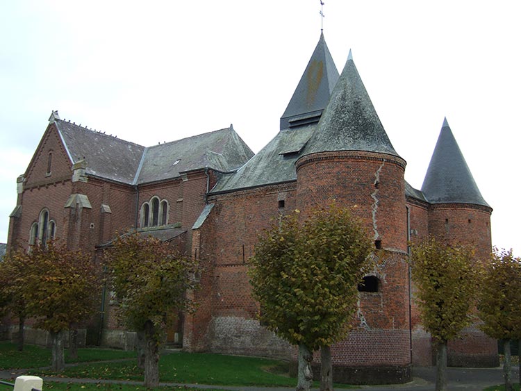
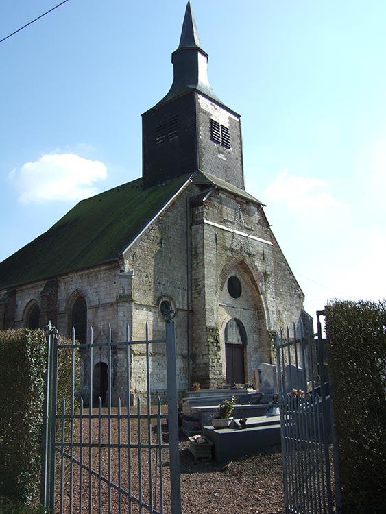
The material used in building changes from honey-coloured stone in the Ardennes to red brick in the Thierache. Here fortified churches were built entirely of small bricks in the seventeenth century. They are massive constructions with solid square keeps and belfries and two tall round towers at the west end.
In the plains of the nord south of Valenciennes most of the cottages are built of red and black bricks, often arranged in diamond patterns. Farmhouses stand at right angles to the street.
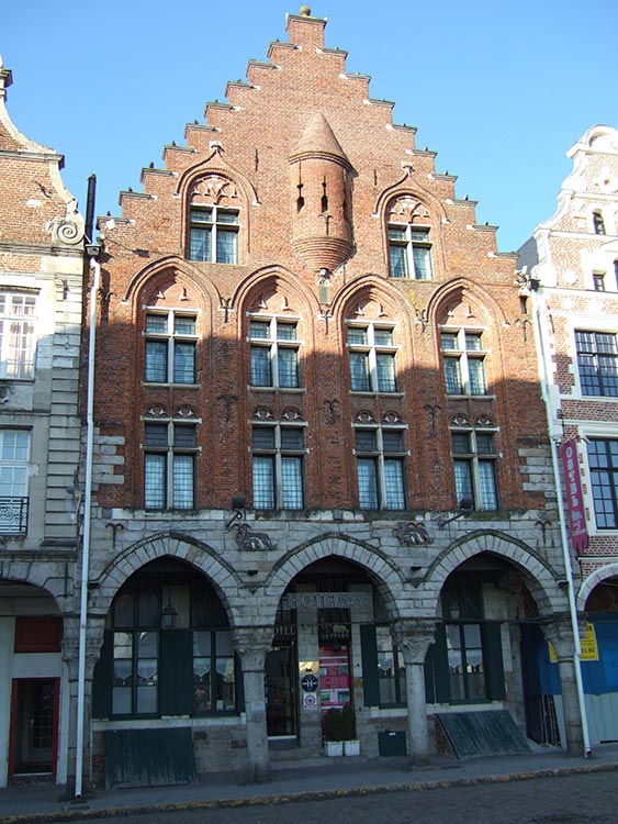
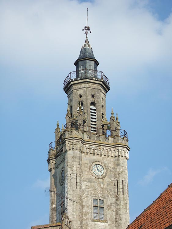
The majestic rippling gables of the Grande Place in Arras, the scrolls and pillars, all speak of solid Flemish prosperity - merchants, markets and fine cloth. The massive belfry supported by the Rennaissance town hall looks like a tiered wedding cake. A watchman at the top would have warned the citizens of an approaching army. In the sixteenth century Arras had wealth worth protecting. It was not part of France but belonged politically to the Low Countries, the richest corner of early modern Europe.
In Artois the distinctive Flemish cottages have walls of patterned bricks and dormer windows. The churches are built of white stone with stocky towers supported by solid buttresses.
The church in Hesdin is a fine example of sixteenth century Flemish church architecture. It is a strange mixture of styles. The twenty three windows with their rich stained glass are decorated with branches and foliage in the late Gothic style. Yet the doorway is a magnificent Renaissance construction with its coffered Roman arch and Corinthian pillars. There are four coats of arms on top including the Habsburg eagle of Imperial Spain.
Population Density
These northern plains are empty of people, although very close to the most densely populated area of Europe - the Low Countries to the north, the industrial areas around Lille and Metz-Thionville, and the Paris basin to the south. The north may contain much of France's industry but there are huge open spaces in between the big conurbations. It is a region of small towns and scattered villages, which have suffered rural depopulation as the cultivation of the great plains has been mechanized. Only around the major cities are workers starting to re-populate these villages. Otherwise many seem asleep and run down, only coming to life at five o'clock when cars return from a long journey to work.
Industrial Decline
Industrial decline has affected many parts of Northern France since the Second World War. Lorraine is struggling to come to terms with the globalised economy of the twenty first century. Steel making is now in decline and the coal mines have all closed. Plants are moving to countries where production costs are lower and many local people are working over the border in Luxembourg, Germany and Belgium, the frontaliers.
This story of depression was repeated many times as I crossed the North - in Verdun, Sedan, Charleville-Mezieres, Le Cateau Cambresis and Arras. Smaller towns which do not have the critical mass to attract outside investment are suffering. Vervins, Catillon-sur-Sambre and Le Quesnoy are good examples.
Fields of Conflict
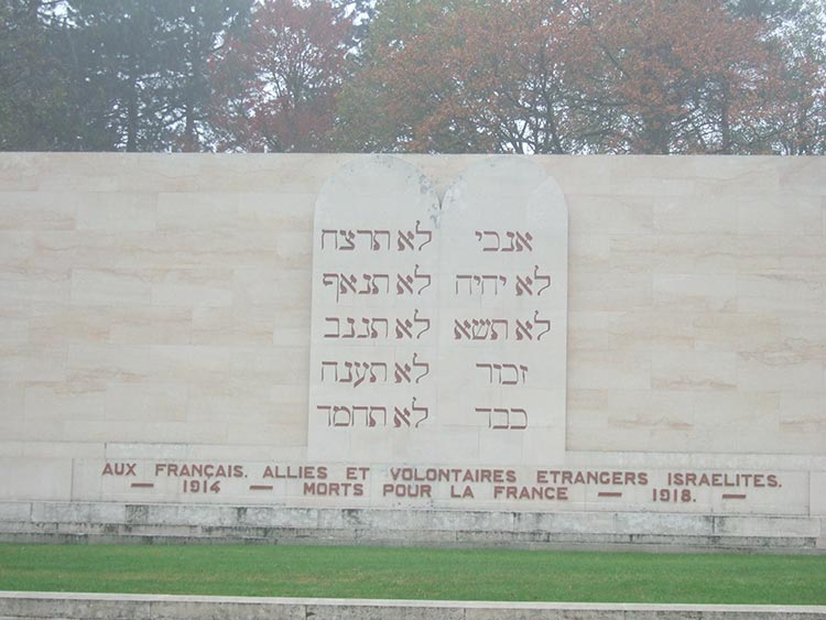
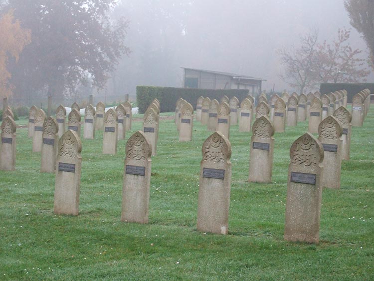
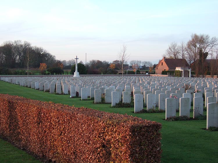
The memory of past conflicts is ever present in Northern France. The struggle with Germany, which lasted on and off from 1870 to 1945, has scarred the North. There are not only many graveyards, French, German, British and American, and monuments to mark the sites of different battles, but also thousands of reminders of individual acts of sacrifice, mainly by the Resistance in World War Two. Every village has its war memorial. War plagued these open plains in every century of France's existence. The evidence for this can be found, for example, in the fortified churches of the Thierache and the forts shielding the northern frontier built by Louis XVI's military architect Vauban at Montreuil and Le Quesnoy.
1870
The battle of Sedan terminated the first part of the Franco-Prussian War. You can still see the hills north of the town where the French chasseurs charged hopelessly against the Prussian guns, the Sub-Prefecture in Sedan itself where the Emperor Napoleon III had his HQ, the village of Bazeilles to the east where the French soldiers fought to the last cartridge, and the Chateau of Bellevue out by the autoroute, where the Emperor surrendered his sword to William of Prussia, later proclaimed the first Emperor of Germany at Versailles.
World War One
The opening shots
Right at the beginning of World War One the French armies launched a wave of frontal assaults on the Germans. These resulted in heavy losses and the French were pushed back towards Paris. There was fierce fighting around Sedan on 27th August 1914.
St. Mihiel Salient
South East of Verdun the Germans managed to push their lines a long way forward during the early fighting in 1914. This bulge came to be known as the St. Mihiel salient. Several German trenches with stone embankments still remain near Flirey. Deeper than the first French trenches and well camouflaged, they were provided with shelters where the troops could rest.
The American memorial to those who fell in the battle to clear the salient in 1918 stands on top of the Butte de Montsec, overlooking the Lac de Madine and the clay plain of the Woevre. It is reminiscent of the Jefferson Memorial in Washington. This battle marked America's arrival on the world stage as a great power. 550,000 US troops took part with 110,000 French. It was the first independent US operation of the war under an American Commander-in-Chief.
Ferocious battles took place in April 1915 around the hill on the Cotes de Meuse south east of Verdun known as Les Eparges. The French tried to drive the Germans off the high ground because they saw it as the key to the German defence of the St. Mihiel salient. They only succeeded in capturing it at an enormous cost in killed and wounded. This battle field is littered with shell holes, trenches and huge mine craters. The remains of Alain Fournier, the young author of Le Grand Meaulnes, are buried in the nearby cemetery at St. Remy La Calonne.
Battlefield of Verdun
The terrain is not at all as it was in 1916. The war scoured the hills of vegetation. It was impossible to return the land to its original state, so trees were planted to hide the main area of conflict.
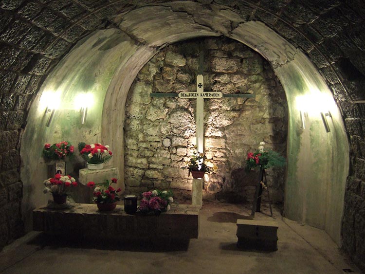
The ossuary at Donaumont with the massive cemetery in front is unfortunately one of the ugliest buildings you will ever see - a long curved vault with an enormous tower. Strangely the ossuary itself was the result of a private initiative and is not maintained by the French government. After the battle a committee was formed headed by the local bishop to give a decent burial to the many remains which could not be identified, both French and German. 130,000 men are commemorated in this way.
Having attacked first on the right bank of the Meuse on 21st February 1916, the Germans opened a second front on the left bank, on the hillside known as Mort Homme, in March. Terrible hand to hand fighting took place and the intensity of the artillery fire from both sides meant that the central part of the ridge could not be held by either army. The struggle continued all summer until the French counter-attacks of August gave them the upper hand. All that is left is a peaceful clearing in the woods, a number of monuments and a kilometre away a military cemetery. Now there are Franco-German visits to remember the dead and a cross erected in 1984 celebrates the old enemies' reconciliation.
The British
For the British Arras is famous because of the battle fought there in April 1917. A whole army hid in the natural chalk galleries or boves under the town. New Zealanders constructed long tunnels up to the German lines and the Allied forces were able to surprise the Germans and drive them back ten miles. The Commonwealth Cemetery in Arras commemorates 35,000 names.
I passed the spot where Wilfred Owen was killed on the Sambre and Oise Canal, only a week before the Armistice.
World War Two
At Sedan I saw Donchery and Glaire to the west, where the Germans led by Guderian crossed the Meuse on 13th May 1940, thus bypassing the end of the Maginot line a few miles away to the East. The most vital crossing point was probably at Glaire where the First Panzer Division threw hundreds of rubber boats into the river. Many were killed but enough survived to rush the weak French defences on the south bank. Waves of Stukas bombarded the Marfee heights during the crossing.
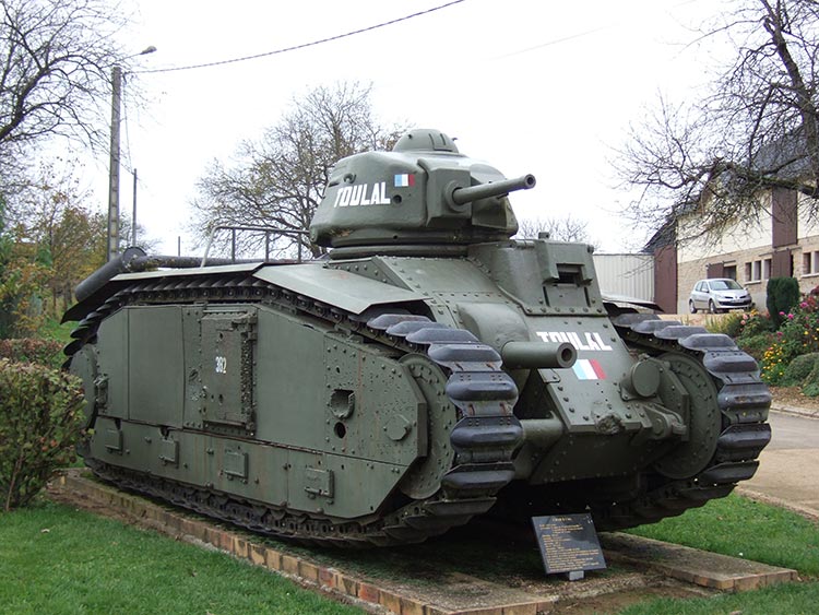
The cross roads at Stonne in the Ardennes was full of memorials. The French had three armoured divisions in the region to oppose the Panzers but they were too slow to make the vital counter-attack which might have checked the Germans. In the fighting which followed at Stonne the village changed hands many times and the French lost between 4,000 and 5,000 men.
Lorraine
In and around Nancy I traced the history of Lorraine, once an independent Duchy in the Holy Roman Empire but absorbed by France in the seventeenth and eighteenth centuries.
Part of Lorraine, the department of the Moselle, joined the German Empire between 1871 and 1918. It was also incorporated into Nazi Germany after 1940.
Lorraine has its own languages - the French patois of the west, now virtually extinct, and Francique, a Low German language still used in the extreme North East.
In the department of the Moselle, as well as in Alsace, the priest can visit the local school once a week to teach the cathecism, and his salary is paid by the state.
Lorraine has a cuisine with distinctive features - e.g. Quiche Lorraine or the local fruit called mirabelles.
Department of the Nord
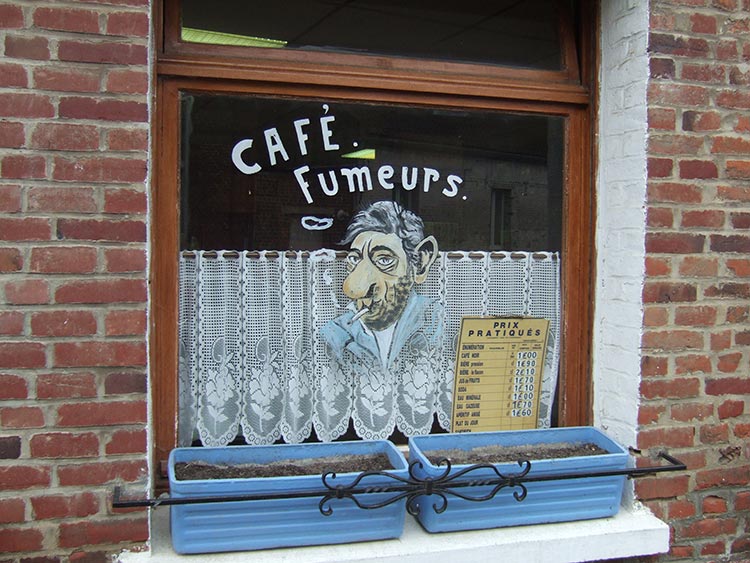
Le Nord has not always enjoyed a good image in the rest of France. It is associated with cold weather, grimy industrial cities and beer drinking inside dark cafes.
Northern cuisine is not really French. One of the favourite dishes is the flammeche, or flammekueche to use the Flemish word, a little like a pizza and often covered in cheese.
Some of the inhabitants even speak a strange dialect called Ch'ti. A recent film in France, Bienvenu chez les Ch'tis, tells the story of a postmaster from Provence who is posted to a small northern town as a punishment for misconduct. Judging from the reaction of his wife and friends he could just as well have been sent to Devil's Island, the notorious French penal colony. In due course the postmaster discovers that life there is not so bad. A Northerner told me that they make up for the poor weather by being warm-hearted - "Ils ont la chaleur dans le coeur parce qu'il fait froid au dehors."
The Channel Coast
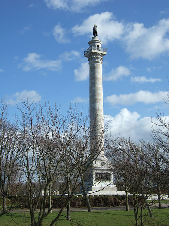
The column on the cliffs bove Boulogne with Napoleon on top does not commemorate the army assembled to invade England but the first awards of the Legion d'Honneur to French soldiers.
Remains of the Atlantic Wall built by the Germans during World War Two still stand along the west coast of France. Much of it was built by forced labour including Jews. Near Boulogne there is a Chemin des Juifs.
Everywhere fishing communities are forced to find other sources of income. In Etaples south of Boulogne I stayed with a former fisherman who works as a guide in a museum of fishing. Local fishermen have also started a superb fish restaurant.
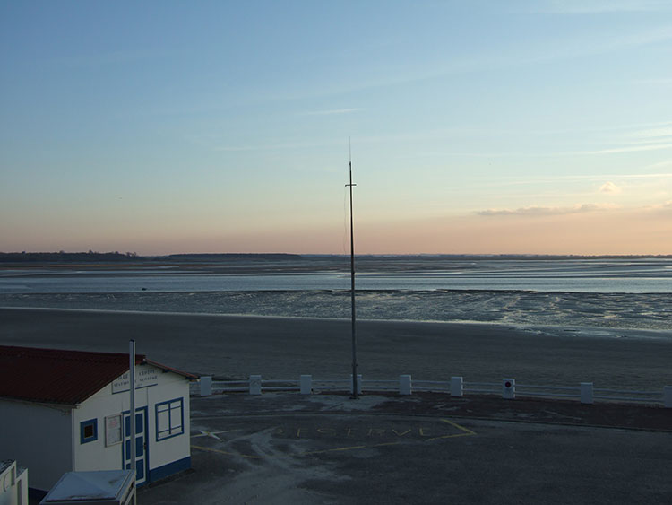
The shoreline of the Bay of the Somme is forty miles long. The dunes to the north shelter the Parc National du Marquenterre, a unique habitat for birds. The retreating tide uncovers enormous mud flats whith floating platforms for wild fowlers to shoot birds. Behind the sea wall polders separated by drainage ditches stretch as far as the eye can see.
The River Somme rises east of St. Quentin, where it connects with the French canal system. Flowing through Amiens to Abbeville it becomes the canal maritime as far as St. Valery-sur-Somme.
Back to top
Diary extracts
A landscape of canals
Gondrexange is a very functional village not far from a cement works and a railway line. However, here the landcape changed as the GR entered an amazing network of canals and lakes or etangs. The Canal de la Marne au Rhin flowed past the village in an elegant curve to enter the Etang de Gondrexange, protected on both sides by massive dykes. Above and around me was a huge expanse of ice cold blue, with the lines of the canal stretching into a flat infinity of water and trees. A heron skimmed across the surface of the etang looking for food. The slanting light of a crisp autumn sun threw my shadow across the dyke ahead. As the sun rose higher a few patches of mist dispersed and I saw a group of fishermen warming themselves in its rays over a glass of red wine. The GR crossed the canal at a junction - left to Nancy, right to Sarreguimines. I followed the Canal des Houilleres de la Sarre (Canal for the Sarre coalfield). It is some time since barges laden with coal ran along this waterway. Now the only noise was the plop of a float dropping into the water as a fisherman shouted a greeting from the opposite bank. The canal entered an azure roofed tunnel of trees, the reflection of their dying shades perfect in the motionless water. A large leaf floated down from above and made a soft landing on the surface. The few seconds of its descent seemed to last a lifetime.
An old border
Ahead the restored spire of Brin-sur-Seille's church stood out against the wooded hills around Nancy. In the distance was the Grand Couronne, north of Lorraine's capital in 1914. The French fought desperately to stop the Germans taking it. From these heights the German artillery would have had Nancy at their mercy and the outcome of the Battle of the Marne, which saved Paris, might have been very different. At Brin I crossed an unremarkable bridge over the river Seille, about ten metres wide at this point and flowing quite fast. I met two old men, one of whom was chopping wood and chatting to his friend. The latter was probably in his seventies. Seeing I was obviously a visitor he said suddenly "that used to be Germany over there in 1914, and in 1940 when I was a boy. The Seille was the frontier. The Germans closed it in the Second World War. You could not cross here then. Too many soldiers about. Far too dangerous." In Occupied France we were now standing in the so called Reserved or Forbidden Zone. Beyond the bridge was the Reich itself.
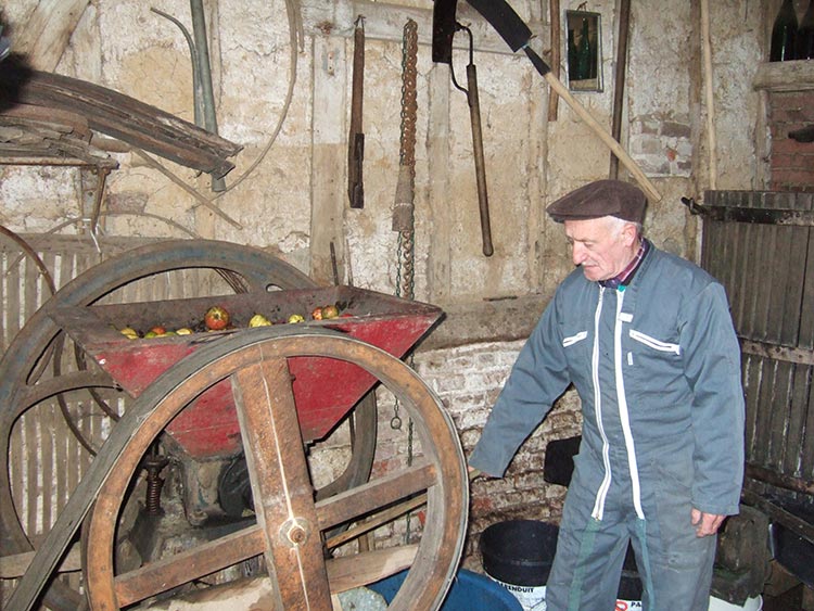
A farmer in the North
"We have farmed in Parfondeval all our lives," said M. Chretien, "and now I have passed the business on to my son. My family have worked this land continuously since the time of my great grandfather. Ihave seen enormous changes in agriculture. My father's farm was 40 hectares and my father and mother worked full time on it assisted by a dairy maid and a ploughman. So there were four of them in the 1930s. I farmed 60 hectares and now my son manages 70 and works entirely alone. We have improved productivity by a factor of eight." This enormous change has happened since 1945 and particularly since the nineteen seventies. What really shook me was that M. Chretien was using horses to pull his plough until the mid-seventies. "I introduced automatic milking machines in the nineteen seventies. Before this I milked by hand. You needed supple fists to do that. You also need a lot of strength to plough with a horse." Brussels' policies and mechanization had been the main catalysts for change. "When farm work was done mainly by hand life was hard, but now we have leisure time to occupy ourselves with nothing!" he said. "In my father's day there used to be a lot of petites exploitations, small holdings of 5-6 hectares, but now they are being consolidated. A lot of young people have left for the grandes villes. It is tres calme in Parfondeval."
A drowned rat
A storm burst and strong gusts of wind drove rain in my face for about thirty minutes. I trudged into Haspres dripping wet looking for a cafe which also served food. No such luck. In desperation I selected an establishment which only sold alcoholic drinks, not even coffee. As I came through the door the eyes of everyone swivelled through ninety degrees to stare at me in silence for what seemed an eternity. I must have looked like an apparition, with water streaming off my waterproofs, rucksack and two walking sticks. At last one of the men said, "Ce n'est pas la saison pour le Saint Jacques!" (He can't be going to Compostela now.)"
A bar in Boulogne
I crossed the A16 motorway and marched past a large hospital into an industrial estate. The atmosphere was thick with smoke in the bar opposite. There were three customers on this quiet Sunday afternoon apart from the couple running the establishment. One man wearing an old cap was propped up on a bar stool. Every time he smiled I noticed that half his teeth were missing. He was already well oiled on pastis and slurred his words. I must have looked like a man from the moon with my rucksack, sticks and walking clothes. Once I had finished a beer and a sandwich they could not restrain their curiosity any longer.
"What are you doing here?"
"I am walking around France."
They raised their eyebrows as if they thought I was mad.
"Are you a soldier?"
"No," I replied,"retraité, retired."
"Do you really do this for pleasure?"
"Is Boulogne une ville qui bouge, a town on the move?" I asked.
The answer was slow in coming and then they said "OK, not brilliant."
One person in four is out of work in Boulogne.
"The introduction of the Euro has put up prices," they complained. "Our salaries are not keeping pace."
This got us onto politics. They were obviously discontented with all their politicians and I noticed the TV was turned off when some election coverage appeared on the screen.
"All politicians are useless," they said. "Why should we bother to vote at all?"
Then they turned on the English.
"Why are you so sceptical about Europe and why haven't you adopted the Euro?"
I tried to explain some economic arguments about setting our own interest rates and made a hash of it. They looked unconvinced. They thought the English were conservative Eurosceptics. They were equally suspicious of the United States.
"The USA has been making war on everyone ever since they dealt with the Indians in North America!"said the old man on the stool.
Among some Frenchmen there is a strong streak of anti-Anglo-Saxon prejudice and their politicians play up to it regularly by criticising suggested reforms as Anglo-Saxon. Our little debate was very amicable however. I shook hands with everyone around the bar before disappearing to find a dead Frenchman who also had no great love for the English, the Emperor Napoleon.
Back to top
The Walk
View more details.
View more details.
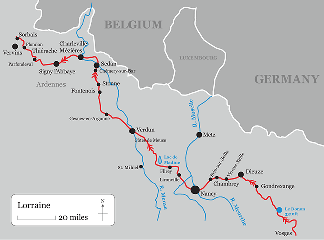
From Le Donon at the end of the Vosges I followed the GR5 across Lorraine to Nancy with local variations, leaving it to walk through the centre of the city and rejoining it at Liverdun, having traversed the Foret de Haye on the GRP Autour de Nancy. I stuck to the GR5 line again, with local variations, until just west of Martincourt, where I turned left to make my way to Verdun on local footpaths. I passed through Flirey, skirted the Lac de Madine, and walked along the Cotes de Meuse into Verdun. From here I used a combination of local paths and short stretches of the GR14 to reach Sedan and Charleville-Mezieres.
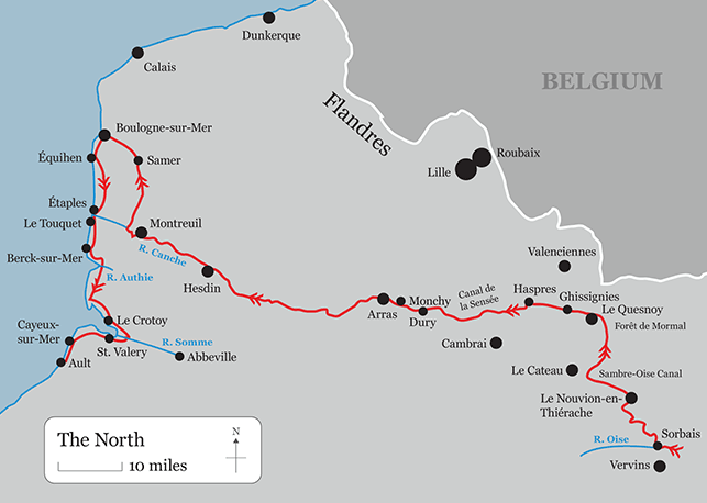
From Charleville I used local paths again through Signy l'Abbaye until I joined the GR122, which I followed through Parfondeval, Plomion and Sorbais (diverting to Vervins for a night's rest). After Sorbais I cut across to Le Nouvion-en-Thierache on local paths, but rejoined the GR122 on the Sambre et Oise Canal, which I followed to Landrecies. With local variations this GR took me through the Foret de Mormal, and from Le Quesnoy I crossed the plain south of Valenciennes on local paths to the Canal de la Sensee. I followed this canal to the junction with the Canal du Nord and then went across country to Dury and Arras.
From Arras I followed the GR121 west with local variations. It runs along the valley of the Canche through Hesdin and Montreuil.
From Montreuil I turned north on local paths and the GR121, through Samer, the Foret Domainiale de Boulogne and Mont Lambert to Boulogne-sur-Mer. From here I had intended to follow the coast path south (Gr du Littoral) but was forced back by heavy seas at Equihen. Here I turned inland on the GR121 and the Chemin des Juifs to the castle at Hardelot, and thence on local paths again and the Chemin des Facteurs to cross the D940 to Dannes. Here I took a side road, rejoining the D940 further on and following it to Etaples. I set off again on the GR du Littoral but diverted inland at Le Touquet on local paths to rejoin the D940 south of Merlimont. I followed this road again as far as Berck Plage. From here I rejoined the D940, cut off through Groffliers, joined the GR120 for a short stretch and the D940, eventually turning right on the D532, and thence on local paths to the bird reserve at Marquenterrre and Le Crotoy. Then I took the path around the edge of the Bay of the Somme to St. Valery-sur-Somme and local footpaths to Cayeux-sur-Mer. From here I walked along the beach to Ault.
The total distance from the Vosges to Ault is approximately 560 miles. The walking across Northern France is relatively easy with few hills of any significance.
Back to top
Maps and Guides
From the Vosges to Nancy: IGN 1:25.000 maps 3616OT, 3715OT, 3615O, 3515E, 3514E, 3514O, 3414E, 3415E, 3315ET
Nancy to Verdun: IGN 1:25.000 maps 3315ET, 3314E; Topoguide PR Le Parc naturel regional de Lorraine Ref. PN03. FFRP; IGN maps 3314O, 3214E, 3213E, 3213O, 3112ET.
Verdun to Charleville-Mezieres: IGN maps 3112O, 3012E, 3011E; Topoguide PR Les Ardennes Ref. D008. FFRP; IGN maps 3010E, 3010O, 3009E, 3009O.
Charleville-Mezieres to Arras: 2909E, 2909O, 2809E, 2809O, 2709E, 2808O, 2708E, 2708O, 2707O, 2706OT, 2606E, 2606O, 2506E; Topoguide Le Nord a pied Ref. D059. FFRP; IGN maps 2506O, 2406E. Topoguide PR Arras et ses environs a pied Ref. P626. FFRP.
Arras to Ault: 2406E, 2406O, 2306E, 2306O, 2206E, 2205E, 2105ET, 2104ET, 2105ET, 2106ET, 2107ET
Back to top
Weather
Be prepared for heavy rain and cold winds outside summer. Remember that some parts of the walk are a long way from towns where medical assistance, accommodation and food might be available.
Back to top
Accommodation
In some places I had difficulty finding accommodation out of season. I list below my particular recommendations . I have not covered every stopping place on my route.
Chambres d'Hotes Chez Josette
(Jean-Pierre et Josette Hermann),
380 route de Lindre-Haute,
57260 Dieuze.
Tel/Fax 00 33 (0)3 87 86 90 13 or
06 87 23 77 19
hermann.jean-pierre@wanadoo.fr
Auberge Winstub de la Petite Suisse Lorraine
4, place Belle Croix,
54380 Griscourt.
Tel/Fax 00 33 (0)3 83 23 66 70
L'Auberge de Flirey
19, rue du Jury,
54470 Flirey
Tel. 00 33 (0)3 83 82 54 54
Fax 00 33 (0)3 83 82 85 07
http://www.auberge-de-flirey.com
Hotel du Lac de Madine
22 rue Charles de Gaulle,
55210 Heudicourt.
Tel. 00 33 (0)3 29 89 34 80
Fax 00 33 (0)3 29 89 39 20
http://www.hotel-lac-madine.com
Hotel du Saumon
Rue Chanzy
08240 Buzancy
Tel. 00 33 (0)3 24 30 00 42
Fax 00 33 (0)3 24 30 27 47
Hotel Le Saint-Michel
3, rue Saint-Michel
08200 Sedan
Tel. 00 33 (0)3 24 29 04 61
Fax 00 33 (0)3 24 29 32 67
Hotel Auberge de l'Abbaye
2 place Aristide Briand
08460 Signy-l'Abbaye
Tel. 00 33 (0)3 24 52 81 27
Fax 00 33 (0)3 24 53 71 72
http://fr.federal-hotel.com/hotel_auberge-de-l-abbaye-signy-l-abbaye_10424.htm
Chambres d'hotes - Francoise et Lucien Chretien
1 rue du Chene
02360 Parfondeval
Tel/Fax 00 33 (0)3 23 97 61 59
http://www.gites-de-france.com/gites/fr/chambres_d_hotes
Hotel de La Paix
37 rue Vimont Vicary
02170 Le Nouvion-en-Thierache
Tel. 00 33 (0)3 23 97 04 55
Fax 00 33 (0)3 23 98 98 39
http://www.hotel-la-paix.fr/fr-tourisme.htm
Hotel La Gentilhommiere
2 rue de L'Eglise
59269 Artres
Tel. 00 33 (0)3 27 28 18 80
fax 00 33 (0)3 27 28 18 81
contact@hotel-lagentilhommiere.com
http://www.hotel-lagentilhommiere.com
La Ferme de l'Abbaye
Christine Choquet
62156 Drury
Tel. 00 33 (0)3 21 58 98 59
Chambres d'hotes La Solette
(Jeannine et Jean Debaisieux)
10 rue du Moulin
62810 Hauteville
Tel. 00 33 (0)3 21 58 73 58
http://www.gites-de-france.com/gites/fr/chambres_d_hotes
Hotel les Flandres
22 rue d'Arras
62140 Hesdin
Tel. 00 33 (0)3 21 86 80 21
Fax 00 33 (0)3 21 86 28 01
Chambres d'hotes La Rodiere
Anne Louchez
77 rue Pierre Ledent
62170 Montreuil-sur-Mer
Tel. 00 33 (0)3 21 81 54 68 or
06 84 01 36 84
Maison d'hotes Par Hasard
13 rue de la Providence
62200 Boulogne-sur-Mer
Tel/Fax 00 33 (0)3 21 91 36 88 or
06 87 58 84 72
Chambre d'hotes La Marina
Jean-Gabriel Bonvoisin
30 rue de la Mer
62630 Etaples
Tel. 00 33 (0)3 21 94 89 70 or
06 07 90 45 82
http://www.lamarinaetaples.com
Villa Saint Georges
Mme Chivot
30 rue Victor Petit
80550 Le Crotoy
Tel/Fax 00 33 (0)3 22 27 77 80 or
06 84 05 87 01
http://www.villa-st-georges.com
Back to top
Photographs
Click on the thumbnails below to see larger images with captions.