The Walks
Normandy
Photo: Terry in President Coty's seat!
The region
Landscape
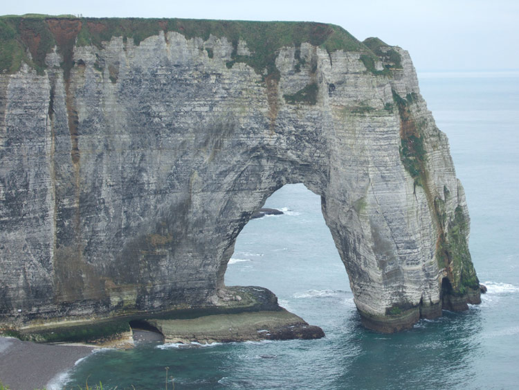
The white cliffs of Upper Normandy run all the way from the Bay of the Somme to Le Havre, a distance of 100 miles. They are fragile and subject to constant landslips. This has protected the coast from over development.
A thin layer of clay top soil covers the solid chalk of the plateau known as the Pays de Caux. The plough turns up flints with every furrow. The sub-soil is riddled with holes like a piece of gruyere cheese.
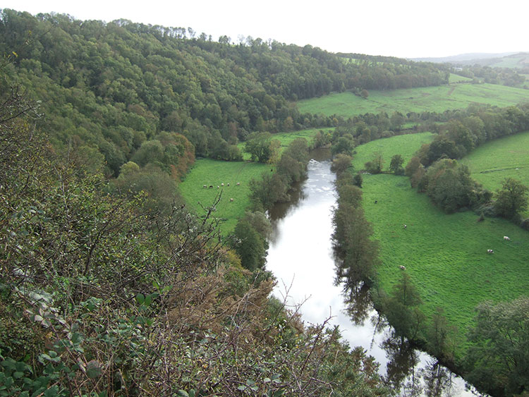
The chalk plateau is divided by narrow V shaped river valleys which support a range of vegetation not seen higher up.
The most famous place to see the cliffs is Etretat with the natural arches made famous by Monet.
The Marais Vernier south of the Seine is the largest peat bog in France.
Once beyond Trouville the cliffs disappear and sand takes over, stretching all the way to the D-day beaches. The land behind the dunes west of Cabourg is a reclaimed marsh, a featureless expanse of meadows intersected by drainage channels.
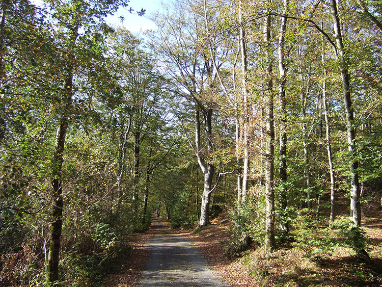
The bocage of Lower Normandy is a landscape of hedges, woods and small fields. It frustrated the Allies after D-day.
Pres sales surround the Bay of St. Michel and the river estuaries, vast expanses of flat land covered in coarse salt resistant grasses. As the Bay silted up over the centuries mud flats were left high and dry and these prairies started to develop. They are ideal for grazing sheep. It is a featureless landscape. Drainage channels pump water under the dike which divides reclaimed agricultural land from the marshes. At low tide the pres sales run out in a sea of oozing mud. Walking across the Bay is dangerous without a guide who knows the tides and the location of quick sands. As high tide approaches the sea races in, covering a huge distance in a short time.
Architecture
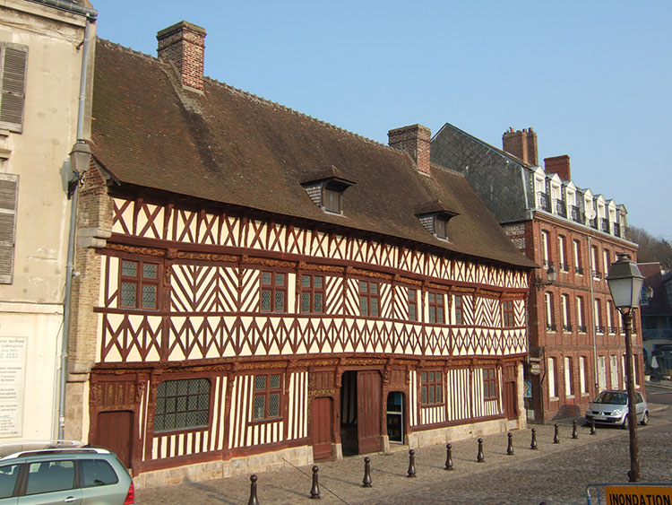
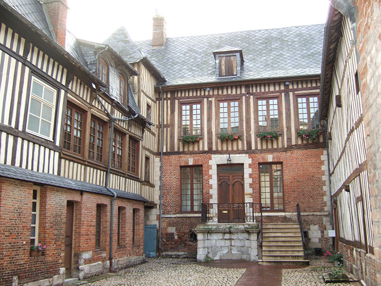
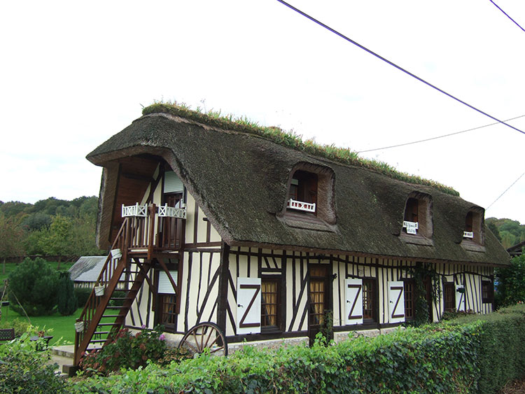
The appearance of buildings is heavily influenced by the availability of local materials. Plaster walls between frames of exposed wooden beams are very common. This method of construction was used for small cottages, farm buildings, manoirs and churches.
Flint is also common in the Pays de Caux.
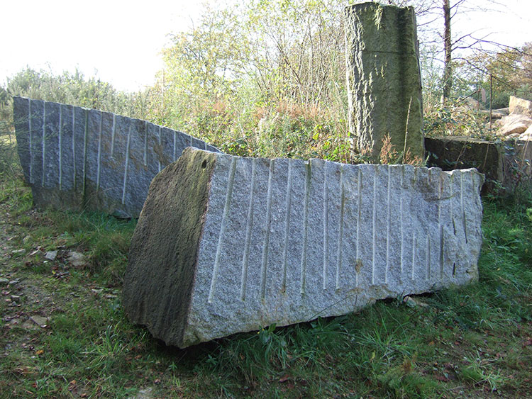
Other local stone is used e.g. puddingstone in Le Beny Bocage; grey and pink granite around Vire and St. Michel Montjoie in Lower Normandy.
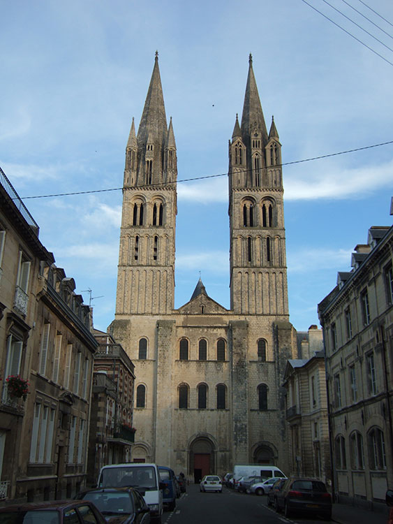
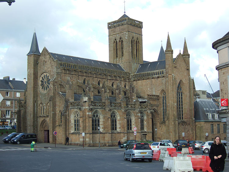
There are great abbey churches in Normandy built under the patronage of the Dukes of Normandy and later the Kings of France. Two such stand at either end of old Caen - the Abbaye aux Hommes built by William the Conqueror and the Abbaye aux Dames built by Matilda his wife.
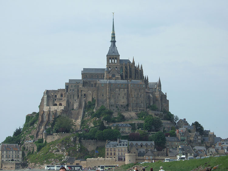
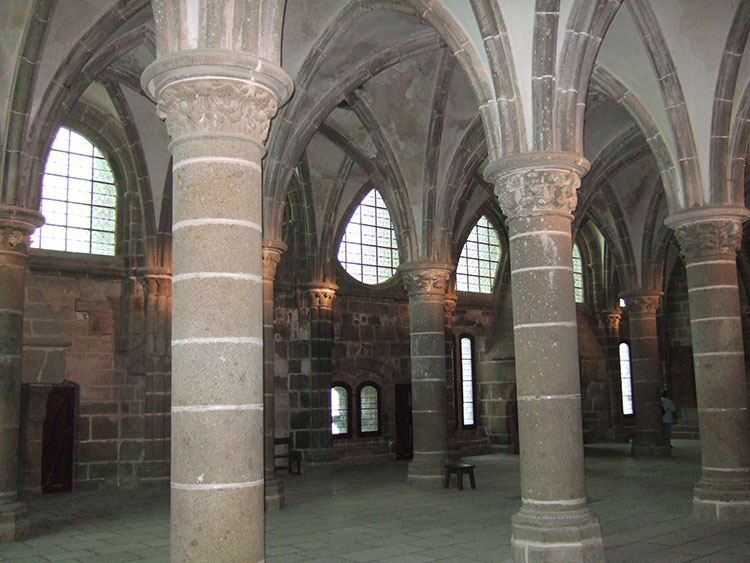
The most famous abbey is on the Mont St. Michel.
History
Duke William is the dominant figure in Normandy's early history. Caen is William's town. The Duchy was for many years ruled by England, but finally passed to France at the end of the Hundred Years' War.
Normandy used to have its own patois, rarely spoken these days.
Earning a Living
Small dairy farmers are disappearing and land is being concentrated into larger farms.
The number of small orchards and cider presses is declining.
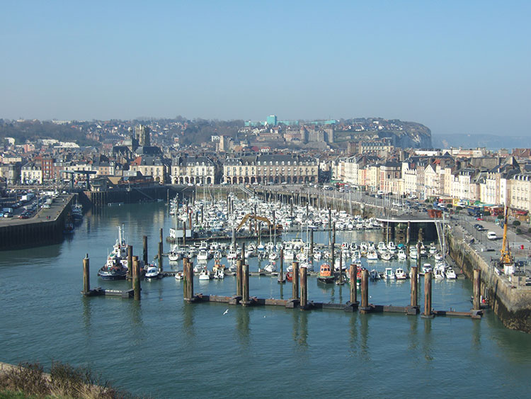
Outisde the major ports like Le Havre there are fewer Normans earning a living from the sea.
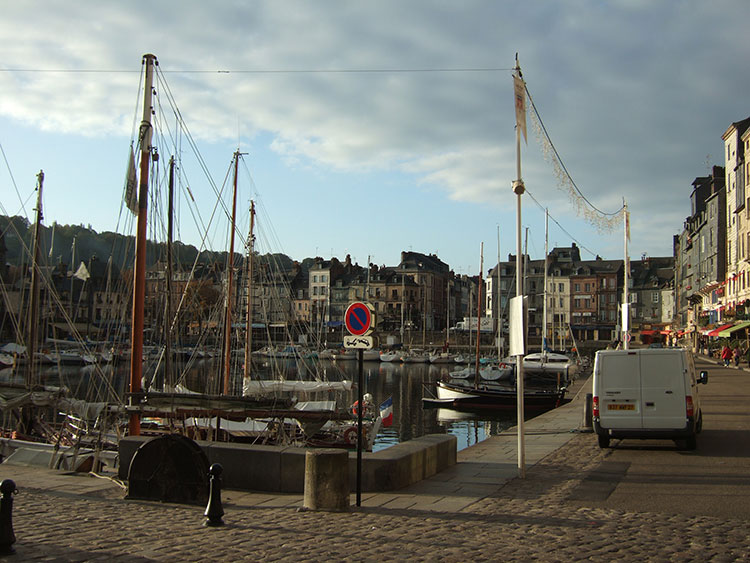
Honfleur has been rescued from decline because it is attractive to tourists.
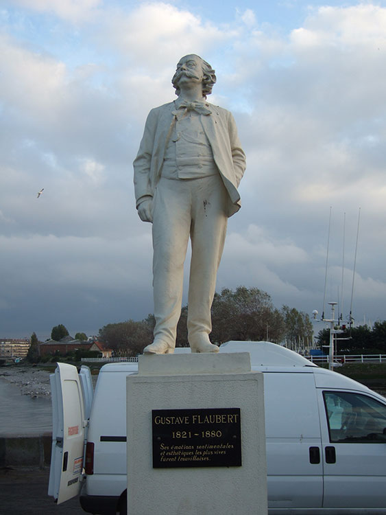
Because the Normandy coast is so near the capital, holiday resorts were developed there in the nineteenth century for the newly rich bourgeoisie - Trouville, scene of Flaubert's childhood holidays, followed by Deauville, Cabourg and Houlgate, all started by property speculators in the 1850s. Now settlements like Varangeville, south of Dieppe, provide a hideaway for the smart set.
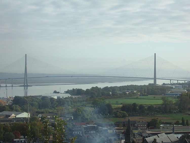
Old industries like tanning in Pont-Audemer have closed down but there is still plenty of evidence of the modern industrial economy - the warehouses and cranes at Fecamp, the docks at Dieppe, the storage tanks and chimneys on the Seine estuary, the nuclear power station at Panuel. The latter employs 2,000 people and so it is vital to the local economy. The Pont de Normandie, which spans the Seine estuary, is the biggest bridge using a network of cables in the world, a mile and a quarter long and with pylons 700 feet high.
Everywhere the grandes villes are spreading out into the countryside, gentrifying many villages and creating dormitory communities.
World War Two
Some units of the British and French armies made their last stand in 1940, not at Dunkerque, but on the cliffs north of Le Havre - at Sotteville, Veules-les-Roses and St. Valery-en-Caux.
The Dieppe raid was carried out by Canadian and British forces in August 1942 to test Hitler's continental defences and learn about amphibious landings. It was a disaster. There are numerous memorials either side of the town.
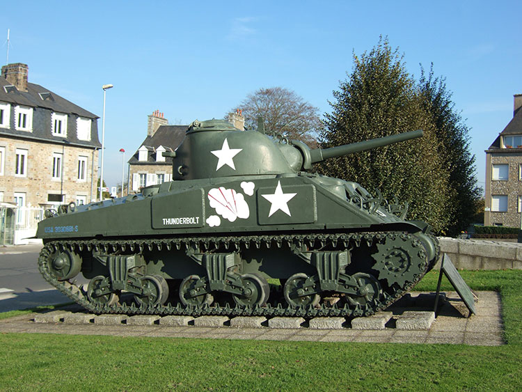
I bypassed the main invasion beaches of 1944 but walked through the theatre of operations on the right bank of the Orne and past the famous Pegasus bridge , captured at the opening of D-day.
I traced the advance of allied troops through Caen and the bocage of Lower Normandy. Vire was almost totally destroyed by allied bombing. Having ruptured the German lines Patton stormed through Avranches on his way to Brittany.
Back to top
Diary extracts
A tea shop in Fecamp
A conversation in Fecamp with a young man illustrates how hard it is for people with limited education to survive in today's economy. Near the promenade I found a salon de the where the young man served tea and a madeleine. Tall, slim and slightly anxious, he told me a lot about the hopes and fears of some young Frenchmen.
His mother owned a hotel and, although quite young, he was already married with a young baby of thirteen months who was crawling around the floor. His wife was a Spanish teacher at a local college. He and others, he claimed, feel there is no work. "Factories are closing down and manufacturing is being moved out of France - every day you hear people talk about delocalisation. Unemployment in Fecamp is high. We have achieved a 70% occupancy rate in the hotel but struggle to make a margin because of rising costs. My mother pays me the minimum wage of 1000 euros a month. However it costs her 1500 euros to employ me because of the high level of social security contributions which employers have to pay. She needs my help because running a hotel is hard physical work but she cannot afford to pay more. We cannot put prices up because of competition. I have a small terraced house over the street but it needs a lot of repairs. We have just enough money to live but nothing to spare." England seemed to be the Promised Land. "I adore London because it is so cosmopolitan." I remembered his parting phrase "one survives in France."
The bombing of Le Havre
Serge, a retired school teacher, recalled his early childhood in Le Havre during World War Two. "My father was a railway worker and we lived hear the main station. In 1944 the RAF started to bomb the docks. I admired the bravery of individual pilots coming in low to pinpoint particular installations with their bombs. Later the Americans instituted high level bombing with waves of planes which destroyed 95% of the old centre of Le Havre. My family's house was hit but not completely destroyed. It was made of wood and ended up leaning at an angle. After the war we managed to push it straight again. We were so pleased when the Germans left Le Havre and the Americans arrived, throwing oranges and chocolates to us kids."
Back to top
The Walk
View more details.
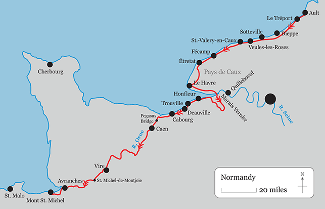
From Ault I used local paths again through St. Quentin-la-Motte-Croix-au-Bailly (one of the longest village names in France) and Eu to LeTreport. Once at Le Treport I used the GR21 down the coast as far as Le Havre. I walked to Harfleur and then followed the GR2 along the Seine as far as the Pont de Tancarville. On the left bank I took the GR23 west and then turned inland at the Pointe de la Roque on the same GR, joining the GR224 to reach Pont-Audemer. From here I continued on the GR224 and GR223, with local variations, through Berville-sur-Mer, Equainville, Ablon, Cremanville and Gonneville-sur-Honfleur to Honfleur itself. From here I walked south-west near the coast, using the GR223 with variations, to Trouville. Crossing the River Touques to Deauville I continued down the coast, using the GR 223 in places, to Cabourg, Merville, the Bay of the Orne and Pegasus Bridge. Here I crossed to the left bank of the canal to follow the GR36 into Caen. From Caen I followed the GR36 south to Thury-Harcourt, continuing on it to St. Martin-de-Sallen, and then turning right onto the GR221A to a point just west of St. Jean-Le-Blanc, where I joined the GR221 proper walking west. When I reached Le Beny-Bocage I turned south on the GR221B to La Graverie and from here to Vire on an old railway track, now a cycle path. From here I continued west on the line of the D524, but using the GR de Pays du Tour du Bocage Virois, which soon turns south. On this GR I skirted the Lac de Dathee and Champ-du-Boult, and using a variant reached St. Michel-Montjoie. Here I joined the GR22 through St. Pois and all the way to Avranches. Then I followed the Sentier du Littoral (GR22-GR223) south to Pontaubault and west to Mont St. Michel.
The total distance from Ault to Mont St. Michel is 373 miles.
Back to top
Maps and Guides
Ault to Le Havre: IGN 1;25.000 map 2107OT. Topoguide GR21 Le Pays de Caux, La Cote d'Albatre Ref. 202. FFRP.
Le Havre to Caen: IGN Maps 1710ET, 1811OT, 1711OT, 1612OT.
Caen to Mont St. Michel: IGN Maps 1612OT, 1513E, 1513O, 1514O, 1414E, 1414O, 1415O, 1315E, 1215ET.
Back to top
Weather
I experienced no particular weather problems except for heavy rains and high winds which interrupted progress down the coastal path.
Back to top
Accommodation
I had no particular difficulty finding accommodation. I list below places which I can recommend. I have not covered every stopping place on my route.
Hotel Le Saint-Yves
Place Pierre Semart
76470 Le Treport
Tel. 00 33 (0)2 35 86 34 66
Fax 00 33 (0)2 35 86 53 73
http://www.hotellesaintyves.com
La Maison d'Ectot
Annie et Patrick Porcher
Hameau d'Ectot
76460 Saint-Valery-en-Caux
Tel/Fax 00 33 (0)2 35 97 88 05
http://www.likhom.com/chambre_hotes
La Ferme aux Canards
Yannick Bourdet
Hameau le Hetre
76540 Sassetot Le Mauconduit
Tel. 00 33 (0)2 35 28 91 44 or
06 20 13 95 75
http://www.alaferme-auxcanards.com
Hotel Normand
2 place J.P.Laurens
76111 Yport
Tel. 00 33 (0)2 35 27 30 76
Fax 00 33 (0)2 35 28 70 37
Chambre d'hotes - Serge et Nicole Bellanger
23 rue du General Faidherbe
76280 Gonneville La Mallet
Tel/Fax 00 33 (0)2 35 13 64 09
Hotel du Dauphin
10 place Pierre Berthelot
14600 Honfleur
Tel. 00 33 (0)2 31 89 15 53
Hotel Le Cabourg
5 avenue de la Republique
14390 Cabourg
Tel. 00 33 (0)2 31 24 42 55
Fax 00 33 (0)2 31 24 48 93
Hotel Le Relais de la Poste
7 rue de Caen
14220 Thury-Harcourt
Tel. 00 33 (0)2 31 79 72 12
Fax 00 33 (0)2 31 39 53 55
Chambres d'hotes Les Treize Vieilles
Pierre et Severine Keller
14770 Saint Jean Le Blanc
Tel. 00 33 (0)2 31 68 80 46 or
06 98 17 71 09
La Maison de la Fontaine
Murielle et Herve
place Docteur Maugeais
14350 Le Beny-Bocage
Tel/Fax 00 33 (0)2 31 09 25 22
lamaisondelafontaine@hotmail.fr
http://www.lamaisondelafontaine.com
Hotel de France
4 rue d'Aignaux
14500 Vire
Tel. 00 33 (0)2 31 68 00 35
fax 00 33 (0)2 31 68 22 65
http://www.hoteldefrancevire.com
Gite d'etape intercommunal Les Cedres
BP 34
50370 Brecey
Tel. 00 33 (0)2 33 89 21 15
Fax 00 33 (0)2 33 89 21 19
Hotesse d'accueil Mme. Carole Alessio 02 33 68 26 81
Hotel de la Croix d'Or
83 rue de la Constitution
50300 Avranches
Tel. 00 33 (0)2 33 58 04 88
Fax 00 33 (0)2 33 58 06 95
http://www.hoteldelacroixdor.fr
Hotel Le St. Michel
Tel/Fax 00 33 (0)2 33 60 02 16
Fax 00 33 (0)2 33 60 37 31
A hotel inside the walls at a reasonable price!
Back to top
Photographs
Click on the thumbnails below to see larger images with captions.